The hardware and bandwidth for this mirror is donated by METANET, the Webhosting and Full Service-Cloud Provider.
If you wish to report a bug, or if you are interested in having us mirror your free-software or open-source project, please feel free to contact us at mirror[@]metanet.ch.
The arcpullr package provides functions for pulling
spatial data from an ArcGIS REST API and formatting those layers into
either sf or Raster* objects (depending on the
layer being requested). These functions provide the basis for retrieving
spatial data housed in an ArcGIS REST API using either spatial or
relational queries. The output from these querying functions is intended
to work seamlessly with other spatial packages already implemented and
established in R. This package was neither produced nor is maintained by
Esri.
#Install directly from CRAN:
install.packages("arcpullr")

# Or the development version from GitHub:
# install.packages("devtools")
devtools::install_github("pfrater/arcpullr")The below example demonstrates how to use arcpullr to
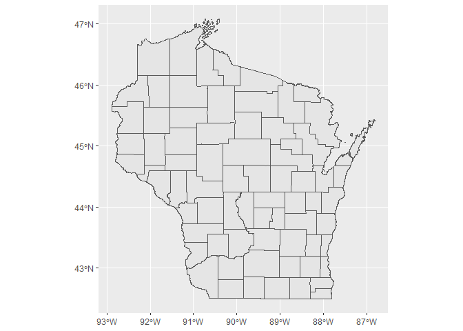
query the Wisconsin
Department of Natural Resources County ArcGIS Rest API
library(arcpullr)
#> Loading required package: sf
#> Linking to GEOS 3.9.1, GDAL 3.2.1, PROJ 7.2.1; sf_use_s2() is TRUE
wdnr_server <-"https://dnrmaps.wi.gov/arcgis/rest/services/"
counties <- "DW_Map_Dynamic/EN_Basic_Basemap_WTM_Ext_Dynamic_L16/MapServer/3"
wi_counties_url <- paste(wdnr_server,counties,sep ="/")
wi_counties <- get_spatial_layer(wi_counties_url)

ggplot2::ggplot() +
  ggplot2::geom_sf(data = wi_counties)
These binaries (installable software) and packages are in development.
They may not be fully stable and should be used with caution. We make no claims about them.