The hardware and bandwidth for this mirror is donated by METANET, the Webhosting and Full Service-Cloud Provider.
If you wish to report a bug, or if you are interested in having us mirror your free-software or open-source project, please feel free to contact us at mirror[@]metanet.ch.
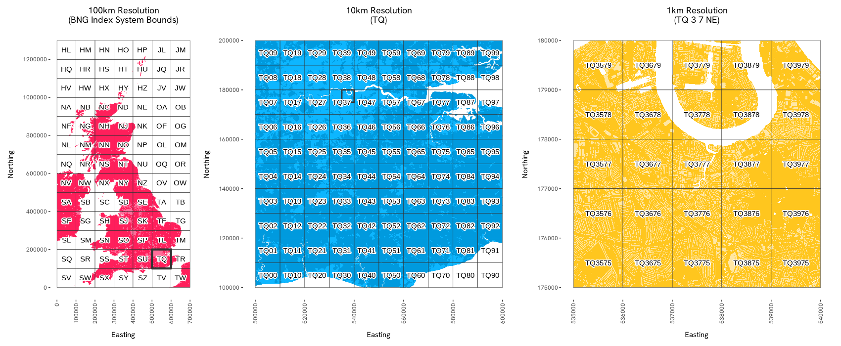
An R library for Ordnance Survey’s British National Grid (BNG) index system. This library provides tools for working with the BNG, a rectangular Cartesian grid system used to identify and index locations across Great Britain into grid squares at various resolutions.
The osbng R package provides a programmatic interface to
the BNG, supporting efficient grid-based indexing and spatial analysis.
This enables applications such as statistical aggregation, data
visualisation, and data interoperability using BNG grid references.
Designed for developers working with geospatial data in the context of
Great Britain, the library offers tools to simplify working with the
BNG, facilitating both technical integration into geospatial workflows
and practical exploration of the index system’s structure.
The package supports the ‘standard’ BNG metre-based resolutions, which represent powers of ten from 1m to 100km (1m, 10m, 100m, 1km, 10km, 100km). It also supports the ‘intermediate’ quadtree resolutions (5m, 50m, 500m, 5km, 50km), identified by an ordinal (NE, SE, SW, NW) BNG reference direction suffix.
osbng is available from CRAN.
install.packages("osbng")Or you can install the latest version of osbng from GitHub with:
remotes::install_github("OrdnanceSurvey/osbng-r")Once installed, load the package to use it:
library(osbng)osbng-py,
a Python package with broad parity to the R package.osbng-grids,
for BNG grid data in GeoParquet and GeoPackage (GPKG) formats.mosaic,
a Databricks package providing geospatial grid indexing using the BNG
for Apache Spark.The osbng package supports different interactions with
the BNG index system (e.g. indexing, hierarchy, traversal). A high-level
summary of each task is provided below:
osbng implements a custom BNG reference object,
BNGReference. The BNGReference object
validates the reference and provides access to custom functions to work
with the reference.
library(osbng)

bng_ref <- as_bng_reference("ST57SE")

print(bng_ref)
#> <BNGReference[1] with Resolution=5km>
#> [1] <ST 5 7 SE>

get_bng_resolution(bng_ref)
#> [1] 5000

get_bng_resolution_string(bng_ref)
#> [1] "5km"Provides the ability to index and work with coordinates and geometries against the BNG index system. This includes:
BNGReference objects at a specified resolution.BNGReference objects back into coordinates,
bounding boxes and grid squares as geos
geometries.geos geometries into grid
squares at a specified resolution for spatial analysis.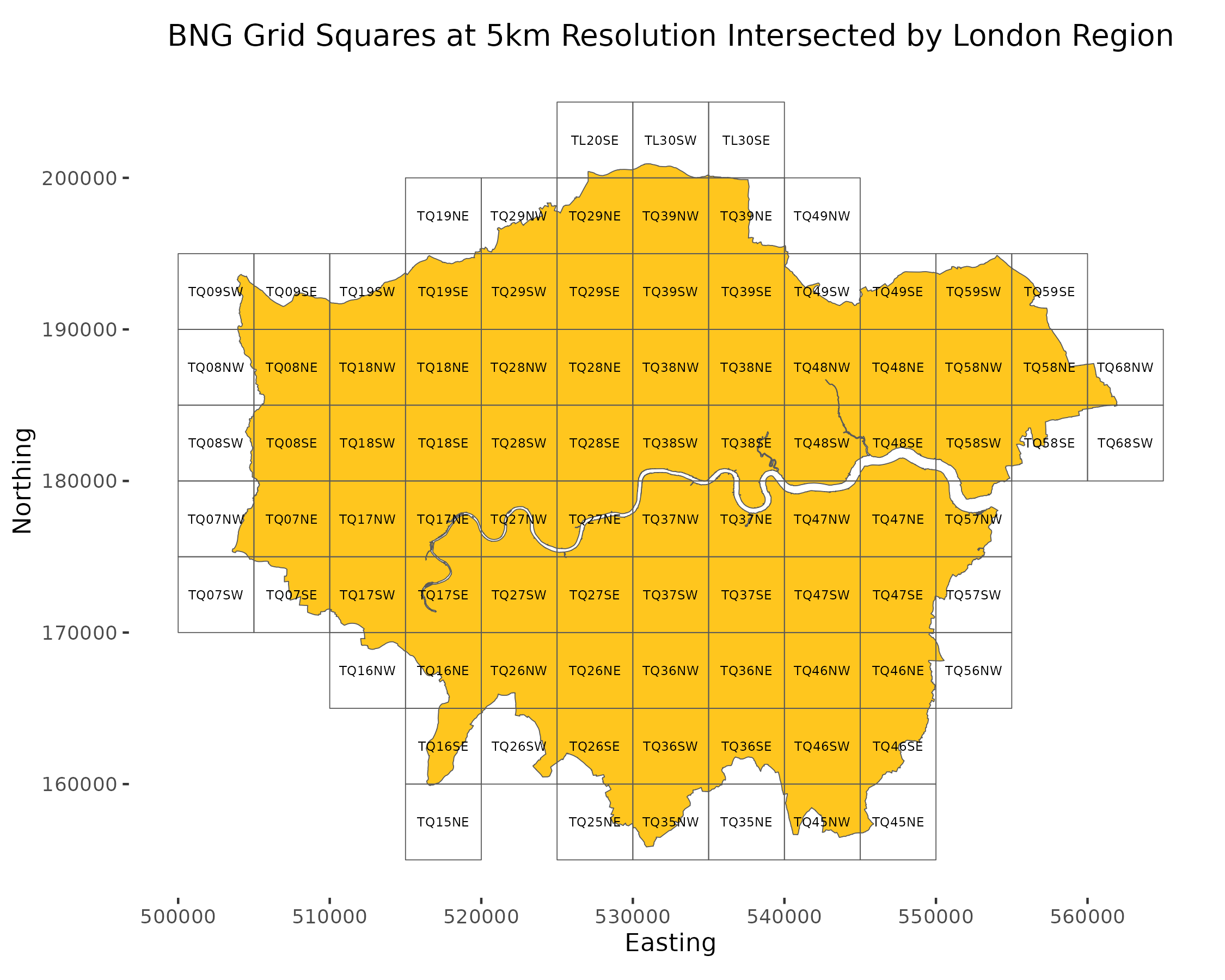
The following example demonstrates a round trip of constructing a
BNGReference object from easting and northing coordinates,
and then decoding back into coordinates, bounding box, and geos
geometry:
bng_ref <- xy_to_bng(easting = 356976, northing = 171421, resolution = "5km")

bng_to_xy(bng_ref, position = "lower-left")
#>        [,1]   [,2]
#> [1,] 355000 170000

bng_to_bbox(bng_ref)
#>        [,1]   [,2]   [,3]   [,4]
#> [1,] 355000 170000 360000 175000

bng_to_grid_geom(bng_ref, "wkt")
#> [1] "POLYGON ((355000 170000, 360000 170000, 360000 175000, 355000 175000, 355000 170000))"Provides functionality to navigate the hierarchical structure of the BNG index system. This includes:
BNGReference objects
at specified resolutions.The following example returns a parent of a
BNGReference:
bng_ref <- as_bng_reference("ST5671SE")

get_bng_resolution(bng_ref)
#> [1] 500

bng_to_parent(bng_ref, resolution = "10km")
#> <BNGReference[1] with Resolution=10km>
#> [1] <ST 5 7>Provides functionality for traversing and calculating distances within the BNG index system. It supports spatial analyses such as distance-constrained nearest neighbour searches and ‘distance within’ queries by offering:
The following example creates a hollow ring of grid squares a distance of k grid squares:
bng_kring(as_bng_reference("SU1234"), k = 2)
#> [[1]]
#> <BNGReference[16] with Resolution=1km>
#>  [1] <SU 10 32> <SU 11 32> <SU 12 32> <SU 13 32> <SU 14 32> <SU 10 33>
#>  [7] <SU 14 33> <SU 10 34> <SU 14 34> <SU 10 35> <SU 14 35> <SU 10 36>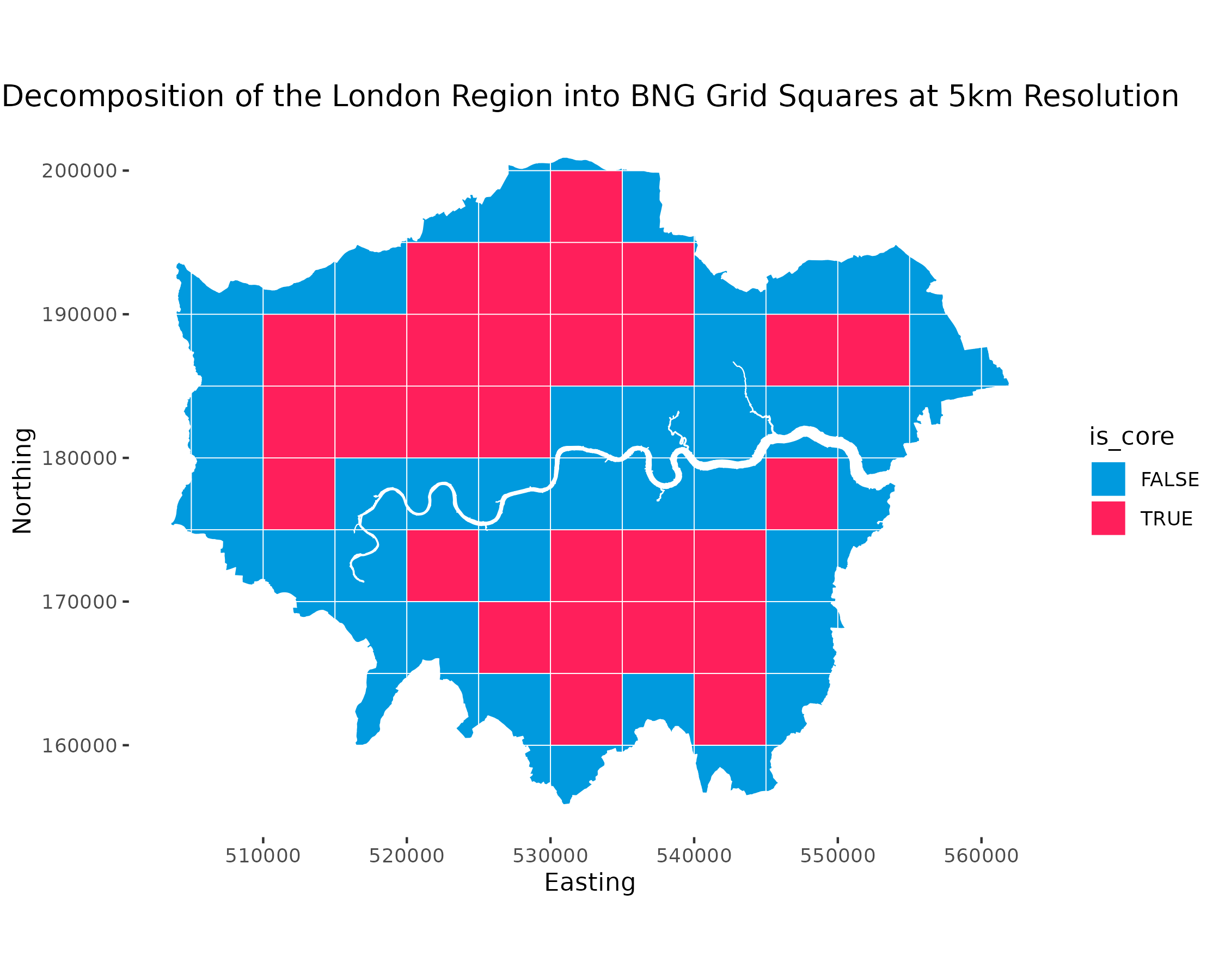
#> [13] <SU 11 36> <SU 12 36> <SU 13 36> <SU 14 36>Provides functionality to generate BNG grid square data within specified bounds. This includes:
This functionality requires the sf package to be
available. The following example constructs an sf data
frame:
library(sf)
#> Linking to GEOS 3.9.1, GDAL 3.3.2, PROJ 7.2.1; sf_use_s2() is TRUE

bng_grid_100km()
#> Simple feature collection with 91 features and 1 field
#> Geometry type: POLYGON
#> Dimension:     XY
#> Bounding box:  xmin: 0 ymin: 0 xmax: 7e+05 ymax: 1300000
#> Projected CRS: OSGB 1936 / British National Grid
#> First 10 features:
#>    bng_reference                       geometry
#> 1           <SV> POLYGON ((0 0, 1e+05 0, 1e+...
#> 2           <SW> POLYGON ((1e+05 0, 2e+05 0,...
#> 3           <SX> POLYGON ((2e+05 0, 3e+05 0,...
#> 4           <SY> POLYGON ((3e+05 0, 4e+05 0,...
#> 5           <SZ> POLYGON ((4e+05 0, 5e+05 0,...
#> 6           <TV> POLYGON ((5e+05 0, 6e+05 0,...
#> 7           <TW> POLYGON ((6e+05 0, 7e+05 0,...
#> 8           <SQ> POLYGON ((0 1e+05, 1e+05 1e...
#> 9           <SR> POLYGON ((1e+05 1e+05, 2e+0...
#> 10 <SS> POLYGON ((2e+05 1e+05, 3e+0...Please raise an issue to discuss features, bugs, or ask general questions.
osbng is licensed under the terms of the MIT
License.
These binaries (installable software) and packages are in development.
They may not be fully stable and should be used with caution. We make no claims about them.